-
-
-
-
-
-
-
-
-
-
-
Florida
-
-
-
-
-
-
-
-
-
-
-
-
-
-
-
-
-
-
| Map of the Bartram Trail |
 65
65
Arrival from Georgia, 1774
 |
|
|
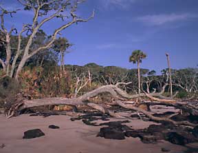
Big Talbot Island, Duval Count |
In March of 1774, William Bartram boarded ship at St. Simons Island, Georgia for the St. Johns River. He was bound specifically for Spalding and Kelsall’s Lower Store, located at present Stokes Landing on the west side of the river about six miles southwest of present Palatka, and to this point he had already dispatched his chest of books and valuable papers.
James Spalding of St. Simons Island was senior partner in the trading firm of Spalding and Kelsall. He gave Bartram letters to his agents instructing them to furnish him with guides, horses and any other assistance needed. Spalding and Kelsall also maintained at present Astor a store called the Upper Store. The Lower Store served as a distribution point for the Upper Store and the trading houses at Alachua and at Talahosochte on the Suwanee River, and was the center to which shipments of Indian goods were sent for dispatch to Savannah or Sunbury and eventually to Europe. The Lower Store was managed by Charles McLatchy, and the Upper Store was under the direction of Job Wiggens and his Indian wife.
As Bartram’s ship ran by Cumberland Island they met a trading schooner from the stores on the St. Johns. Passengers on the trading vessel told of recent raids by the Indians upon both Spalding stores, and the captain determined to return to Frederica on St. Simons Island for instructions. Bartram, however, was anxious to proceed, and he prevailed upon the captain to put him ashore on Cumberland Island so that he might continue his journey. (Bartram identifies this as Little St. Simons Island, but it is today known as Cumberland.) Aside from Fort William, at the southern end of the island, most of Cumberland was then uninhabited, accounting for Bartram’s report of “harsh treatment from thorny thickets and prickly vines.”(66) He was taken to Amelia Island, Florida, by the captain of Fort William.
Bartram landed on the north end of Amelia Island and crossed present Clark’s Creek (formerly Egan’s Creek) to the headquarters of Lord Egmont’s plantation. Mr. Egan was plantation agent or manager. The plantation contained between eight and nine thousand acres, and a townundefinedEgmont Townundefinedlaid out in 1770 on the northern end. Bartram remained several days on this plantation and reported that he was much impressed with the fine state of cultivation, particularly of the indigo. According to local historians, the indigo plantation was in the northeastern sector of present Fernandina. Bartram observed here several very large Indian mounds. Francis Harper’s commentary in the Naturalist’s Edition of Bartram’s Travels notes that in 1940, remnants of one large sand mound and three shell mounds existed. The sand mound was on the grounds of Public School No. 1 on the north side of Atlantic Avenue near 12th Street. A large part of it had been removed in building the school or grading the grounds, so that it was impossible to tell how high it had originally been. The remnant was about 10 feet above the general level. This had been described by Brinton,(67) who estimated its height at 20 to 35 feet and reported that human bones and utensils had been disinterred. One of the shell mounds was about 200 yards south of the Amelia Island Lighthouse, the second about 3/8 mile east near Clark’s Creek, and the third about a mile south of the first.
Bartram left the Egmont Plantation by boat, passing through Kingsley Creek and across Nassau Sound. His party probably camped on the north end of Talbot Island, as Bartram reported a well of fresh water there; Faden’s Atlas of 1776 shows a small spring in that location. They then proceeded by way of Sawpit Creek and Sister Creek to Cow-Ford, present Jacksonville. At that time there was a public ferry there, and nearbyundefinedprobably in the area of Arlington on the east side of the St. Johns opposite JacksonvilleundefinedBartram secured a small boat and fitted it with sails for the journey up the river.
Bartram mentioned that it was now about the middle of April. After leaving Cow-Ford he probably camped first in or near present Ortega. The next day he recrossed the river to the vicinity of Goodby’s Creek where he visited the Marshall Plantation (formerly Greenwood’s, familiar to him from his earlier travels with his father). The next plantation after Marshall’s was very likely at New Switzerland Point in St. Johns County where Francis Philip Fatio of Berne, Switzerland, had received a grant in 1772. He may well have been the host who assured Bartram that the trouble with the Indians had been settled and that he might proceed up the river without fear.
Bartram sailed up the river to Picolata where he found the old fort dismantled and deserted. On a previous visit here in 1765, he had attended a congress with the Lower Creek Indians (68) called by Governor Grant. This was also near the spot where he had tried his hand as a planter of rice and indigoundefinedand failed some eight years before.
His next camp was very probably in the area of Hibernia near the mouth of Clark’s Creek in Clay County, on the west bank of the river. His description of the giant live oak corresponds closely to the great oak still standing at Hibernia as late as 1940. He next stopped somewhere between Racy Point and Tocoi Creek; the description of the still lagoon indicates that it might well have been the cove at the mouth of Tocoi Creek.
Bartram kept along the west shore, probably crossing between Racy Point on the east shore and Nine Mile Point on the west, the logical place to have crossed to shorten the distances in the curving river. He spoke of “doubling a long point of land”(69)undefinedmost likely Forrester’s Point on the east shore three miles north of Palatka He described the promontory and Indian settlement on the site of Palatka. Some of the Indian youths were fishing; others were shooting frogs with bows and arrows. Some of the women were hoeing corn. Bartram reported a large orange grove at one end of the village with trees large and carefully pruned and the ground beneath them clean, open and airy. Several hundred acres were cleared for cultivation around the village, much of which was planted in corn, beans, potatoes, squash, pumpkins, melons and tobacco.
Bartram stopped at Rollestown (or Charlotia), located on the east shore of the river between East Palatka and San Mateo. Rollestown was a social experiment in settlements under the direction of Denys Rolle, who peopled his grant with vagrants, beggars, debtors and women of the street. It was first established in 1764 and led a fitful existence, receiving occasional shiploads of shiftless settlers who soon drifted elsewhere. At the time of Bartram’s visit in 1774, only the overseer and the blacksmith and their families were in residence. Florida Power and Light Company now has a generating plant on the site of this ill-fated settlement.
At Rollestown Bartram secured directions to the island to which the traders had removed their goods at the time of the Indian raids. This was Murphy’s Island, about seven miles up river from Rollestown. It is a large, shell-based island with low swampy areas at each end but a high and hammocky section in the middle. It lies just up river from Dunn’s Creek. Upon arrival there, Bartram found that his chest and its contents were intact and would shortly be removed with the trade goods back to the Lower Store, so he went on to the store.
Stokes Landing’ site of the Lower Store, is now a fishing camp, facing Stokes Island a short distance off shore. According to local tradition, the store stood in a grove of live oak trees (still standing) some hundred yards west of the landing, for here some very old bricks from a well or chimney were excavated. Some Seminole pottery has also been recovered from this site.
A few days after his arrival at the Lower Store in April, Bartram joined a trading party preparing to leave for the trading house on the Alachua Savanna near the Indian village of Cuscowilla on Tuscawilla Lake near present Micanopy. (Micanopy is in Alachua County; it was the first permanent white settlement in that county and was earlier known as Wanton and later as Fort Defiance.) Cuscowilla was founded by the famed Chief Cowkeeper of the Creeks. Chief Payne of Cuscowilla gave his name to Payne’s Prairie (the Alachua savanna) and Chief Micanopy gave his name to the town which now stands on the site of Cuscowilla.
 |
||
|
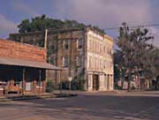
Micanopy, site of the Seminole village of Cuscowilla |
From the Lower Store Bartram and his party traveled southwest about four miles to Camp Branch, crossing Deep Creek, and passing present Kenwood. Beyond Kenwood the old trail passed north of Hewitt Lakes, across Little Cabbage Creek, to present Johnson. A mile and a half west of Johnson lies Cowpen Lake (Bartram’s Halfway Pond). The party crossed Little Orange Lake, Lochloosa Creek (near the north- western corner of Orange Lake), the River of Styx, Tuscawilla Lake and arrived at the village of Cuscowilla.
The Indians had moved from their village of Alachua on the border of the great Alachua savanna (present Payne’s Prairie, crossed by Highway 441 just south of Gainesville) to Cuscowilla on the edge of Lake Tuscowilla because of the “unhealthiness, as they say, occasioned by the stench of putrid fish and reptiles in the summer and autumn, driven on shore by the alligators, and the exhalation from marshes of the swamps, together with the persecution of the musquitoes.”(70)
Only a small garden spot was planted at each Indian habitation in Cuscowilla. Most of their planting was done on the rich lands bordering the savanna. Youths from the village were on guard by day against predatory animals and birds; by night the men patrolled the corn fields against bear, deer and raccoons. Bartram, who made two sketches of the savanna, described it as follows:
“The extensive Alachua savanna is a level green plain, above fifteen miles over, fifty miles in circumference, and scarcely a tree or bush of any kind to be seen on it. It is encircled with high, sloping hills, covered with waving forests and fragrant Orange groves, rising from an exuberantly fertile soil. The towering magnolia grandiflora and transcendent Palm stand conspicuous among them…Herds of sprightly deer, squadrons of the beautiful fleet Siminole horse, flocks of turkeys, civilized communities of the sonorous watchful crane, mix together, appearing happy and contented in the enjoyment of peace, till disturbed and affrighted by the warrior man.”(7l)
 |
|
|
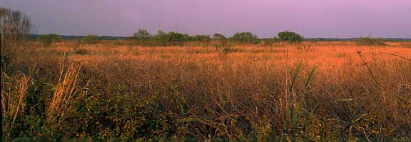
Payne’s Prairie State Preserve |
|
Much of the savanna was under shallow water at the time of Bartram’s visit; periodically it has drained itself naturally through the Alachua Sink or Great Sink, near the northeastern border of the savanna. The State of Florida now owns this property; it is a refuge and once again animals feed there in “the enjoyment of peace.” Before the state of Florida acquired this property, it had been largely drained by canals to provide better pasture for cattle. (Bartram noted the ulcers on the cows grazing in the swampy area which resulted from their continuous contact with swamp water.)
Bartram explored the savanna extensively during his stay in the area, and then returned to Spalding’s Lower Store. The old Spanish highway of which he spoke was probably not the main road from St. Augustine to Pensacola (since that lay about twelve miles to the north and ran from Melrose toward the natural bridge over the Santa Fe River). More likely, it was the path marked “Path to Latchua” on the Purcell map of 1779.(72) Bartram’s party probably crossed this branch of the highway about 1 1/2 miles south of Prairie Creek and continued northwest to the vicinity of present Rochelle, then along the course now followed by the Atlantic Coast Line Railroad, and then to Lochloosa Creek. Between Lochloosa Creek and present Hawthorne they fell into the old trading path and encamped for the night at Halfway Pond (Cowpen Lake) as before, returning next day to the Lower Store. The date of the return would have been in early May, 1774.
About the middle of May, Bartram set sail up the river to visit Spalding and Kelsall’s Upper Store at present Astor on the west side of the river five miles above Lake George. The traders went ahead in their large boat filled with trade goods and Bartram followed in his small boat. He mentioned passing Mount Hope (so named by his father on the previous ascent of the river), a shell mound at Beecher Point on the east side of the river at the north end of Little Lake George. This mound has since been removed for use as a road-building material. The indigo plantation Bartram mentioned there was probably one owned by John Tucker. At Mount Royal (Fruitland Cove) the party spent a night with a former Indian trader, one Mr. Kean.
The party passed between the two large islands at the north end of Lake GeorgeundefinedHog Island on the west and Drayton’s Island on the east. They camped at the south end of Drayton’s Island. At the time of Bartram’s visit, the island, about three miles long and a mile and a half wide, held the remains of a large Indian village including an Indian mound and a grand avenue or Indian highway. Since that time, some development and home building has taken place on the island and these archeological sites are not readily visible.
After crossing Lake George, some fifteen miles wide and about fifteen to twenty feet deep, they camped one night at Cedar Point [Zinder Point] on the eastern cape where river and lake meet. The following day they reached the Upper Store.
Bartram remained at the Upper Store only a few days before leaving to visit at a plantation 60 miles further up the river. He was accompanied on departure by a young Indian who had agreed to help him with the boat. This companion, however, soon tired of his labors and deserted on the first day out. Bartram’s first camp was apparently in the vicinity of Manhatten, some three miles from the Upper Store on the west side of the river. He traveled through Lake Dexter and camped at a shell mound on the west bank (Bartram’s Mound).(73) Most of the shells have been removed for road materials. Here occurred Bartram’s encounter with the alligators which he described so vividly in his Travels.
 |
|
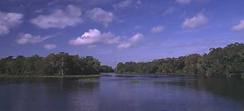
Upper St. Johns River, Volusia County |
At this site Bartram also described the immense school of fish pushing through the narrow pass of the river into Lake Dexter (the river here is perhaps 125 yards wide), and the assault on these fish by a great number of voracious alligators. Bartram referred to the area as the Battle Lagoon. As late as 1939 an area in Lake Dexter was locally known as the striking ground because of the great numbers of large-mouthed bass that break the surface or “strike” there. Bartram spoke of the small young fish of a bright silver color at which the fish were strikingundefineddoubtless the Florida Lesser Shad, or Shadine.(74)
Bartram was apparently moving up the river without haste, as he spent two or three days covering about 18 miles from Lake Dexter to Lake Beresford. He called his first camping place “Musquito Grove” and the description indicates that it was accurately named. This is about six miles above Lake Dexter and is shown on the river charts by the name Bartram used.
On the second night he apparently camped at St. Francis, a shell bluff on the west bank midway between the lakes. This was a point of great archeological importance because here Bartram found that in camping after dark he had
“…unwittingly taken up my lodging on the borders of an ancient burying ground; sepulchres or tumuli of the Yamassees, who were here slain by the Creeks in the last decisive battle, the Creeks having driven them into this point, between the doubling of the river, where few of them escaped the fury of the conquerors. These graves occupied the whole grove, consisting of two or three acres of ground; there were near thirty of these cemeteries of the dead, nearly of an equal size and form, they were oblong, twenty feet in length, ten or twelve feet in width, and three of four feet high.”(75)
Unfortunately, subsequent cultivation and removal of the shell for road building materials have obliterated the traces of the Yamassee burial place.
The “high bluff” Bartram spoke of exploring was present Hawkinsville on the west side of the riverundefinedperhaps one-half mile long and fifteen feet above the river.
About the first of June (Bartram’s chronology is notoriously subject to error) he arrived at his destination, Beresford Plantation, owned by Lord Beresford and managed by a Mr. Bernard, who had invited Bartram to be his guest.
Bartram’s host took him to visit Blue Springs, east of the St. Johns in Volusia County. The outlet creek runs about half a mile before flowing into the river. Bartram remarked on the odor and taste of the sulphur water, commenting that “this tepid water has a most disagreeable taste, brassy and vitriolic, and very offensive to the smell, much like bilge water or the washings of a gun barrel, and is smelt at a great distance.”(76) This was the southernmost point reached by Bartram during his journey of 1773–1777.
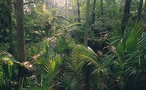
Blue Springs is now a state park. The surroundings have been preserved in as natural a state as is compatible with public use and care has been taken in establishing walkways to disturb as little as possible the native plants. The trail passes through a typical “hammock” area of broad-leafed trees.(77) Manatees can still be seen in the spring run. There are fish in the lower part of the run, but not in the boil itself because of the deficiency of oxygen there. The spring is the largest in the St. Johns River Basin and the second largest in the entire state. 105 million gallons of water per day at an even year-round temperature of 72° boil up from the limestone formation deep below. A marker at the spring quotes John Bartram’s description at the time of his visit there on January 4, 1766.
 |
||
|
Hammock in early morning, Blue Springs State Park |
||
In the discussion of this area, Bartram mentioned New Smyrna and the Mosquito River. “I was there about ten years ago when the surveyor ran the lines or precincts of the colony,”(78) he observed. This is a trip not covered by either the Travels (1773–1777) or John Bartram’s account of his 1765-1766 trip. It is quite possible that William visited the site during his yearlong residence near Picolata (1766–1767), perhaps in the company of J.G.W. DeBrahm, His Majesty’s Surveyor-General for the Southern District of North America.
Apparently he did not linger for a long visit but soon set out on his return journey. He camped again near St. Francis and possibly at Spring Garden Creek, which enters Lake Dexter from the east. He was moving back down the river in very leisurely fashion, and the following night probably camped at Orange Bluff (or Bluffton) on the east side of the outlet of Lake Dexter. Although this was only about three miles above the Upper Store, he spoke of spending still another night at some point on the east bank.
He remained for several days at the Upper Store, collecting specimens and arranging those already collected for transportation to the Lower Store. On his return to the Lower Store, he again camped at Cedar Point, then touched on the small island he called “The Isle of Palms.” This island no longer exists as such; it may have been overtaken by the advancing delta.
He camped about two miles south of the outlet of Silver Glen Springs (Johnson Springs to Bartram), and it was here that the incident occurred in which the wolves made off with the fish hanging over Bartram’s sleeping head, leaving him unharmed and grateful that the animals had not attacked him as he slept. He followed the “run” of Six Mile Springs (present Salt Springs) to its source and camped there, exploring the area in all directions. His description of Salt Springs itself is one of his most beautiful passages. He camped on the next night at Rocky Point on the northwestern part of Lake George. The island “in the bay” where he spent a night was again undoubtedly Drayton’s Island, where his host would have been Mr. Kean of Mount Royal. The return to the Lower Store was in early June, 1774.
Since the account of a trip on the St. Johns which appeared in Travels is actually a composite of two trips, one must allow for a number of minor discrepancies and questions as to his actual camping places and routes.
About the middle of June, 1774, Bartram set out on a journey to the trading house at Talahasochte on the Little St. Juan’s (Suwanee) River. Besides the riding horses, the caravan included a number of pack animals. The first day’s journey took the party about 25 miles to the Halfway Pond (Cowpen Lake) which was evidently a favorite camping spot. Nearing Cuscowilla the next day, the party divided, some for the town and some for the Alachua savanna. Bartram chose to accompany the latter group. The logical point for the party to divide would have been a mile or so east of the River of Styx and north of Orange Lake. From here

|
Manatee Springs |
|
Bartram probably crossed the River of Styx about three miles above its mouth. The “old Spanish highway” of which he wrote would have been a branch passing by the Alachua savanna and Talahasochte to St. Marks on Apalachee Bay. “After passing along the southern border of the Alachua savanna,” according to Francis Harper, “the trading path continued about 4 miles westward to Kanapaha Sink. Groves of ancient live oaks still bordered the sink in 1940 at this secluded and attractive spot. A road extending from the southwestern corner of the Alachua savanna to this point and then five or six miles west-southwest to Archer probably approximates the old trail. On the way to Archer the road passes over sandy, gravelly ridges about 30 feet higher than Kanapaha Sink. The little lakes or ponds probably constitute what is now known as Watermelon Pond. In dry seasons it consists of a series of ponds; in wet seasons it is said to extend for about eight miles in a southeast-northwest direction. The eastern end lies about five miles west of Archer.”(79)
The sinks described by Bartram are typical of the area and were probably a few miles from present Bronson. Either near the Big or Little Wacasassa River would have been the location of the night’s camp, because there are practically no other streams in the area. From the vicinity of the Big Wacasassa River they traveled about ten miles to Long Pond, which is two miles south of Chiefland in Levy County.
The site of Talahasochte is locally believed to have been at present Ross Landing, a bluff about six miles upstream from Manatee Springs. Although there is one bluff between Manatee Springs and Ross Landing, the potsherds found there are of types earlier than Seminole, dating from the Weeden Island period.
Bartram’s description of the Suwanee as “pellucid” is no longer accurate, for the waters are of a dark coffee color today. He was misinformed by the Indians as to the tributaries of the Suwanee, as Suwannoochee Creek, the Alapaha, Withlacoochee and Santa Fe Rivers all flow into it.
Manatee Springs, still bearing the name Bartram used, is located about seven miles from Chiefland in Levy County. Today it is included in a state park and a walkway leads from the “boil” of the spring to the Suwanee River. The eruption of the spring is still intermittent as Bartram described, requiring 34 seconds from peak to peak. 49,000 gallons of water per minute flow from the spring. Dense plant growth is visible in the clear water, and numerous fish can still be seen.
Bartram’s excursion across the Suwanee apparently followed the trading path for a mile and a half upriver, then turned west five or six miles to the vicinity of the California Creek headwaters, then north eight or nine miles to the area of present Old Town, before returning to the river and recrossing to Talahasochte.
It is believed that the Alligator Hole described by Bartram is Blue Sink in the pine woods about a mile north of Newbury. This is now on private property, but the owner, Mr. Rufus H. Roland, is receptive to visitors if they make prior arrangements through him to visit the site.
Bartram’s party camped again near the Wacasassa River, at Long Pond near Watermelon Pond and at Kanapaha Sink. The camp near Cuscowilla was probably at the River of Styx. From this point they presumably retraced the previous route to the Lower Store by way of Halfway Pond (Cowpen Lake).
Bartram made one “little voyage” up the river from the Lower Store during the latter part of July, 1774. He camped at Mount Royal (Fruitland Cove) and revisited Salt Springs. The deserted plantation mentioned was probably on the eastern shore of Lake George. The long point of flat rocks was doubtless Lake George Point opposite Drayton’s Island. He camped again at Mount Royal and from that point returned to the Lower Store.
Charles McLatchy, manager of the Lower Store, invited Bartram to accompany him to the Indian village on the site of present Palatka for a feast of melons and oranges. After enjoying the elaborate hospitality of the Indians, Bartram’s party returned to the Lower Store where the trading schooner was making ready to leave for Frederica on St. Simons Island in Georgia.
Because the vessel was not ready to sail, Bartram availed himself of an opportunity to cross the river with a party taking horses to range. In crossing, he passed among Seven Sisters Islands and Stokes Island and landed at present Buffalo Bluff.
Although Bartram’s Travels refer to his departure downstream as being about “the last of September,” it was probably later, since his report to Fothergill extends his stay on the St. Johns at least until early November. In that report he mentioned the weather turning cooler and the passing flights of migratory fowl. The route from the St. Johns to St. Simons Island retraced the passage during the spring, passing from the river into Nassau Sound by a channel near Fort George Island, and continuing between the coastal islands and the mainland to Frederica, Georgia.
Pensacola Visit, 1775
While waiting for a ship to take him from Mobile to the Pearl River further west, Bartram decided “to fill up this time” by joining a boat destined for the Perdedo River “for the purpose of securing the remains of a wreck.”(80) His subsequent arrival in Pensacola was “merely accidental and undesigned.” Although he “designed to conceal my avocations,” Bartram was soon introduced to Governor Chester of West Florida, who:
“Commended my pursuits, and invited me to continue in West Florida in researches after subjects of natural history, etc. nobly offering to bear my expences [sic], and a residence in his own family as long as I chose to continue in the colony…”(8l)
Although his visit to Pensacola was a brief one, Bartram was evidently impressed by the city and gives detailed descriptions of it in his Travels.(82)
Anxious to continue his trip to the Mississippi, Bartram returned by boat to Mobile shortly after his arrival.
Florida Visits, 1776
Unfortunately Bartram’s Travels does not give details of his activities during the spring and summer of 1776, and his field journals from this period have been lost. We do know, however, that he revisited “several districts of... the East borders of Florida.”(83) Judging from this reference, it is unlikely that he covered any new ground in Florida, but, if an 1832 biography by George Ord can be believed, this is the time when Bartram joined a revolutionary force for the purpose of repelling a rumored British invasion of St. Augustine.(84) [See Section I.] The invasion never materialized and Bartram returned to Philadelphia shortly thereafter.
Footnotes
65. For this account of Bartram’s trip through Florida in 1774, the Bartram Trail Conference is indebted to Dorothy Driggers, op. cit.N.B. Page numbers for all Bartram quotations will be given in the following way: The first page number cited will be the page on which the passage appears in the first (Philadelphia 1791) edition of the book; the second page number will be the page on which the passage appears in Francis Harper’s Naturalist’s Edition. For convenience in checking the original source, Harper’s edition provides both systems of pagination. When third or fourth numbers appear, they refer to Harper’s commentary, also in the Naturalist’s Edition.
66. Bartram’s Travels, p. 65, Harper, p. 42.
67. Daniel G. Brinton, Notes on the Florida Peninsula; Its Literary History, Indian Tribes, and Antiquities, Philadelphia, 1859.
68. For further information on this treaty, see Marjory Stoneman Douglas, “A Treaty Signing, 1765,” Born of the Sun, a Florida State Bicentennial publication.
69. Bartram’s Travels, p. 90, Harper, p. 58.
70. Ibid., p. 193, Harper, p. 123.
71. Ibid., pp. 187–188, Harper, pp. 119-120.
72. Mark F. Boyd, “A Map of the Road From Pensacola to St. Augustine, 1778,” Florida Historical Quarterly, 17, p.24.
73. W. S. Blatchley, A Nature Wooing at Ormond by the Sea, Indianapolis, 1902, p. 196.
74. Harper, Naturalist’s Edition, op. cit., p. 355.
75. Bartram’s Travels, p. 139, Harper, p. 88.
76. Ibid., p. 145, Harper, p. 92.
77. Hammock is an Indian word meaning “shady place.”
78. Ibid., p. 144 footnote, Harper, p. 91.
79. Harper, Naturalist’s Edition, op. cit., p. 371.
80. Bartram’s Travels, p. 414, Harper, p. 262.
81. Ibid., p. 415, Harper, p. 262.
82. Ibid., pp. 415–417, Harper, pp. 263-264.
83. Ibid., p. 467, Harper, p. 295.
84. See: Francis Harper, “William Bartram and the American Revolution,” Proceedings of the American Philosophical Society, Vol. 97, No. 5, October 1953; and Naturalist's Edition, op. cit., p. 416.

